Have you ever attempted to find a map of all of the trails on Monte Sano? No? Go ahead and open a new browser window and take minute... What did you find? If you are like me you probably found a map from Monte Sano State Park, a map from the Land Trust, some trails on google maps, and if you dug deep maybe some stuff from Briatech.com. Most of it very good information, some of it's conflicting, and some of it's old. What you didn't find is a one stop shop for it all.
Over the last year I have compiled information from multiple sources and ran every trail in and around Monte Sano no mater how insignificant. This is a clearing house of information, and a one stop shop for all of your trails. There will be one large collective map covering everything and each and every trail is listed below alaphbeticly with its own map and featured article (coming soon). At the bottom of the page you will aslo find list a GPX repository of each trail.
| Monte Sano State Park Trail List | ||
| Trail | Steward | Length (Miles) |
| Alms House | Land Trust | 1.76 |
| Arrowhead | State Park | 5.5 |
| Bankhead | Land Trust | 1.25 |
| Big Cove Turnpike | Burritt | 0.4 |
| Bluff Line | Land Trust | 2.57 |
| Bog | State Park | 0.5 |
| Bucca Family | State Park | 2.9 |
| Bucca | State Park | 0.3 |
| Bushwhacker Johnson | Land Trust | 0.26 |
| Buzzards Roost | Land Trust | 0.36 |
| Cold Spring | Land Trust/StatePark | 0.7 |
| Discovery | Burritt/Land Trust | 0.21 |
| Discovery South | Burritt | 0.13 |
| Dummy Line | Land Trust/State Park | 1.32 |
| Fagan Springs | Land Trust | 0.76 |
| Fire Tower | State Park | 1.4 |
| Flat Rock | Land Trust/Private | 8.5 |
| Flat Rock North Connector | Private | 0.4 |
| Flat Rock K2 Connector | Land Trust/Private | 0.3 |
| Gaslight | Land Trust | 0.23 |
| Goat | State Park | 2.6 |
| High | Land Trust | 1.47 |
| Hotel Basin | Land Trust | 0.12 |
| Logan Point | State Park | 1 |
| Keith | State Park | 0.5 |
| McKay Hollow | State Park | 2 |
| Mountain Mist | State Park | 2.5 |
| Natural Well | State Park | 2.5 |
| North Plateau Loop | State Park | 1.2 |
| Oak Park | Land Trust | 0.9 |
| Oak Tree Trail | Burritt | 0.1 |
| Old Railroad Bed | Land Trust | 1.7 |
| Old Wagon Road | Burritt | 0.05 |
| Panther Knob | State Park | 0.3 |
| Quarry Road | Land Trust | 0.22 |
| Red Lizard | Private | 0.4 |
| Rock Bluff Trail | Burritt | 0.7 |
| Sink Hole | Land Trust | 0.11 |
| Sinks | State Park | 1.2 |
| South Plateau Loop | State Park | 3.5 |
| Stone Cuts | State Park | 0.8 |
| Stone Cuts Bypass | State Park | 0.2 |
| Three Caves Loop | Land Trust | 0.26 |
| Toll Gate | Land Trust/State Park | 1.63 |
| Trough Springs | Burritt/Land Trust/State Park | 1.34 |
| Wagon | Land Trust | 2.23 |
| Warpath Ridge | State Park | 0.5 |
| Waterline | Land Trust | 0.76 |
| Watts | Land Trust | 0.42 |
| Wild Flower | Land Trust | 0.58 |
| Young-Kennedy | Land Trust | 1.53 |
The Maps
Trail Run Project is a community sourced repository of trails. I discovered this site in early 2015 and have been adding trails and photos ever since. During my travels I have added trails in California, Colorado, Illinois, and Indiana but a majority of what I have added has been in Northern Alabama. From their site you can explore the trails, post conditions, and report hazards like the sink hole on Cold Spring Trail in early 2016. They also have a free app for both Apple and Android products where you can install any states "Trail Areas" where they will then be available offline. The other sources that I used to research the trails are the Monte Sano State Park Trail Map, the Land Trust Trail Map, Briatech Trail Map, and the Burritt on the Mountain Trail Map. Trail Run Project
Land Trust
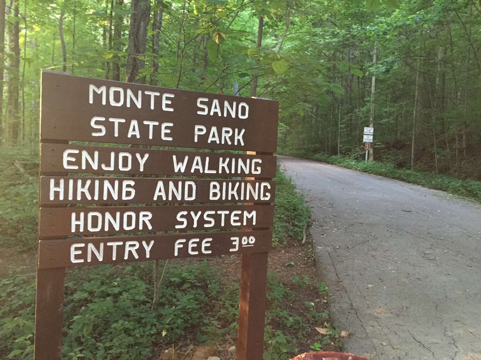
Monte Sano State Park
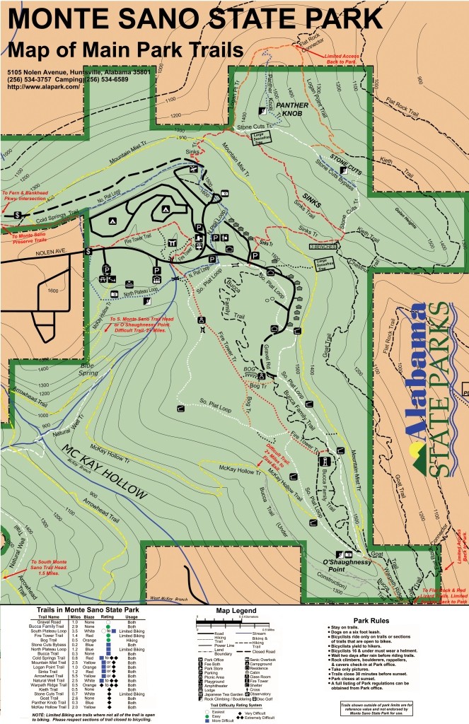
Here is a link to the .jpeg file download from the Monte Sano State Park.
SORBA
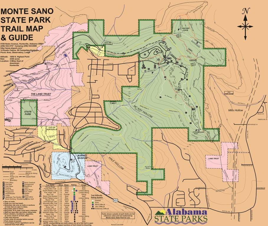
Here is a link to the .jpeg file download from SORBA of Huntsville that is a combined map of the State Park, Land Trust, and Burritt.
Burritt On the Mountain
Briatech
This was last updated in 2003.
GPX Files
I have uploaded the GPX files to the CLOUD! Click HERE to browse and download.